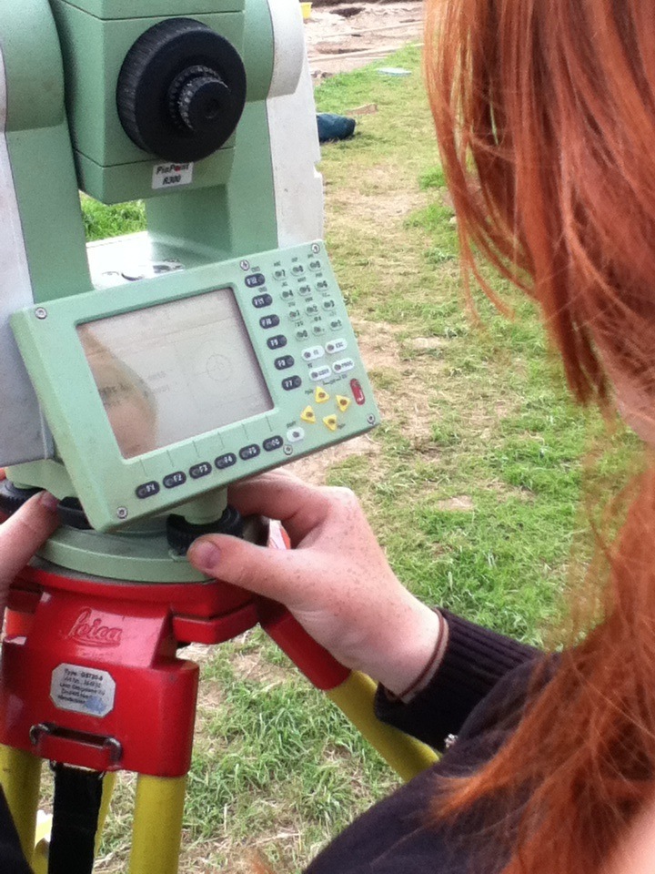
Archaeology student Vicky is photographed here calibrating the total station in order to to impose a grid (X-northing, Y-easting, Z-elevation) on the site to locate every artifact and feature in 3-D space and to make topographic maps of the site.
By continuing to use this website you consent to the use of cookies and your personal data as set out in our privacy policy. Close
Privacy & Cookies Policy
Privacy Overview
This website uses cookies to improve your experience while you navigate through the website. Out of these cookies, the cookies that are categorized as necessary are stored on your browser as they are as essential for the working of basic functionalities of the website. We also use third-party cookies that help us analyze and understand how you use this website. These cookies will be stored in your browser only with your consent. You also have the option to opt-out of these cookies. But opting out of some of these cookies may have an effect on your browsing experience.
Necessary cookies are absolutely essential for the website to function properly. This category only includes cookies that ensures basic functionalities and security features of the website. These cookies do not store any personal information.