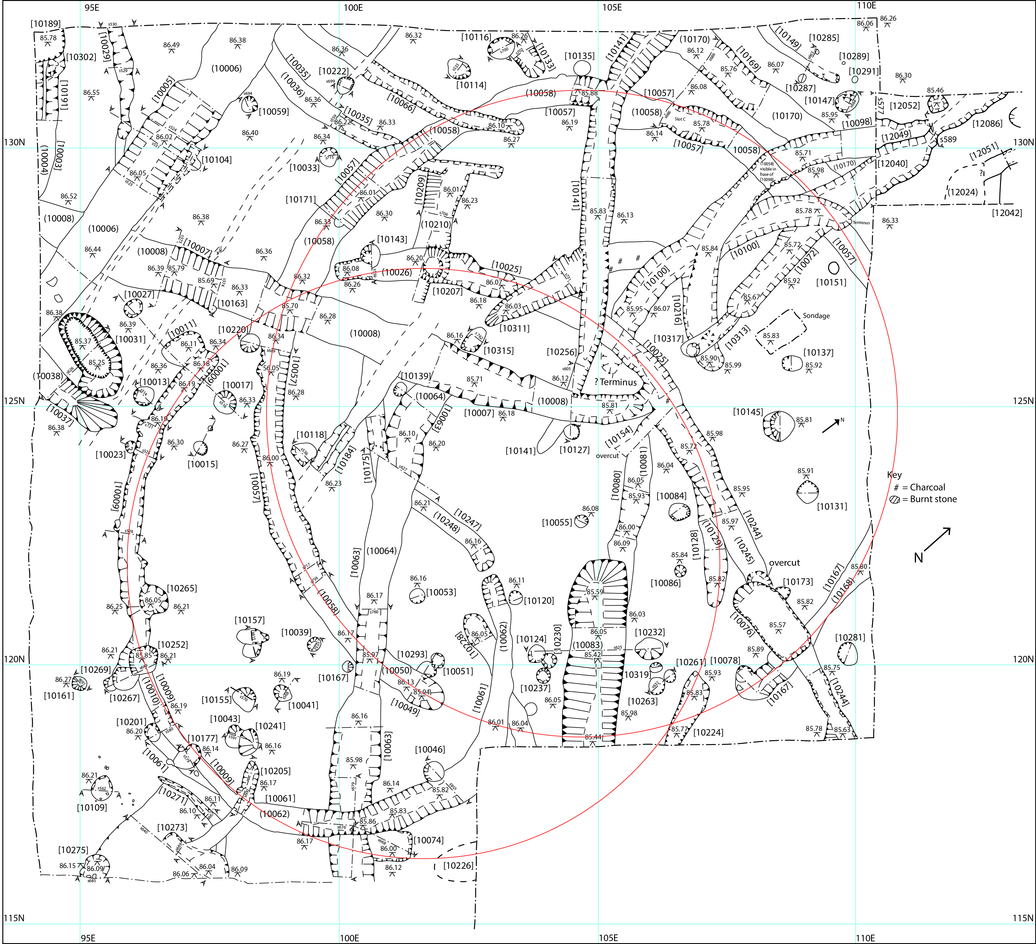
Hi everyone, we thought you might be interested to see the completed final excavation plan of Trench 10 excavated in June 2016. This plan represents a composite of all of the measured drawings made by our students and volunteers during the dig. These field drawings were then digitised by scanning the originals into a computer and then tracing over them using a digital graphics software package. The Individual digitised drawings were then stitched together to make the whole.
The original drawings were drawn at a scale of 1:20. The scale of the finished drawing is indicated by the blue grid lines which are each 5m apart.
The position of the two roundhouses is indicated by the red circles. The northernmost one contained mostly Iron Age pottery in the fill of its ring ditch, but also a Romano-British jar darting from the mid-3rd century AD, or later. The southern one contained Middle and Late Iron Age pottery in its fill. There are numerous other segments of ring ditch suggesting continuous occupation over an extended period of time as well as several different phases of rectilinear ditched enclosures.
John Davey